Version 0.25
Who else this plant feeds, and the study that says so
August 8, 2026
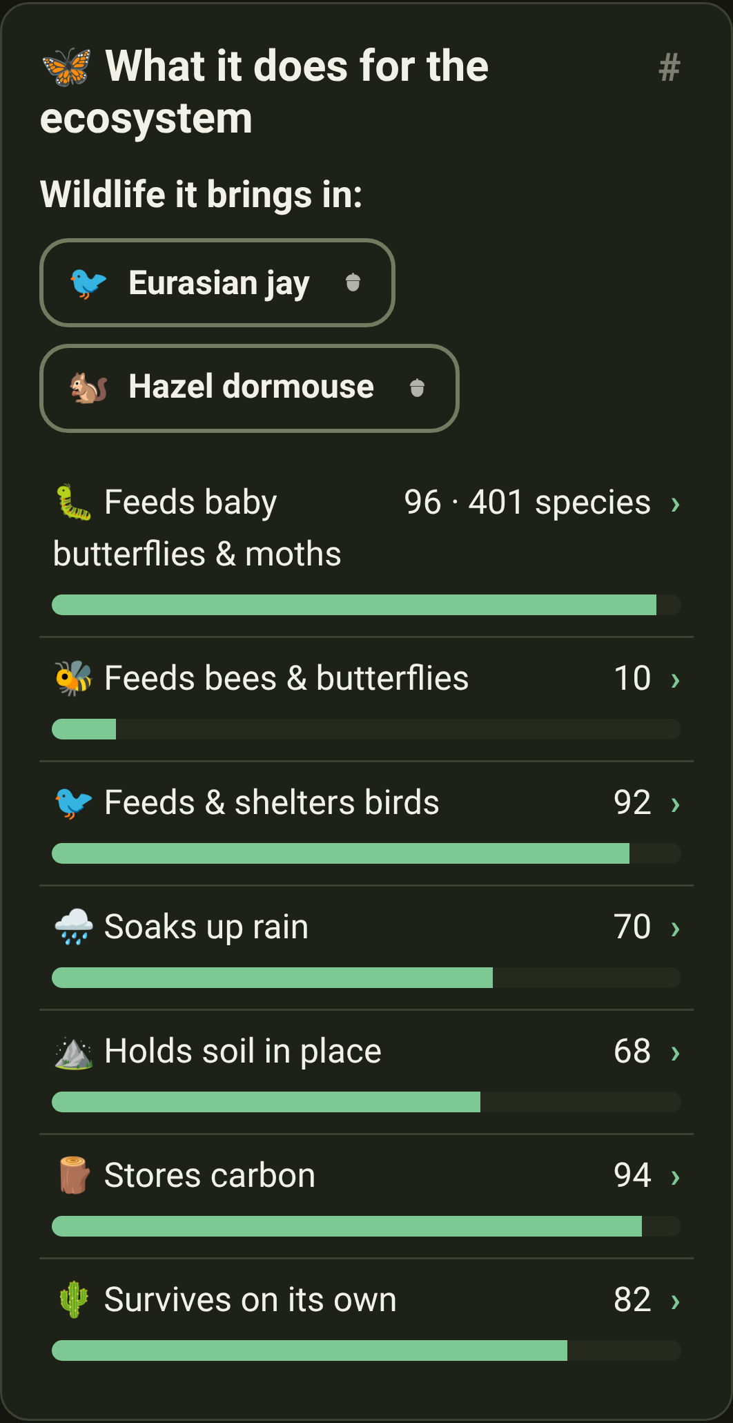
The oak's page before · and after
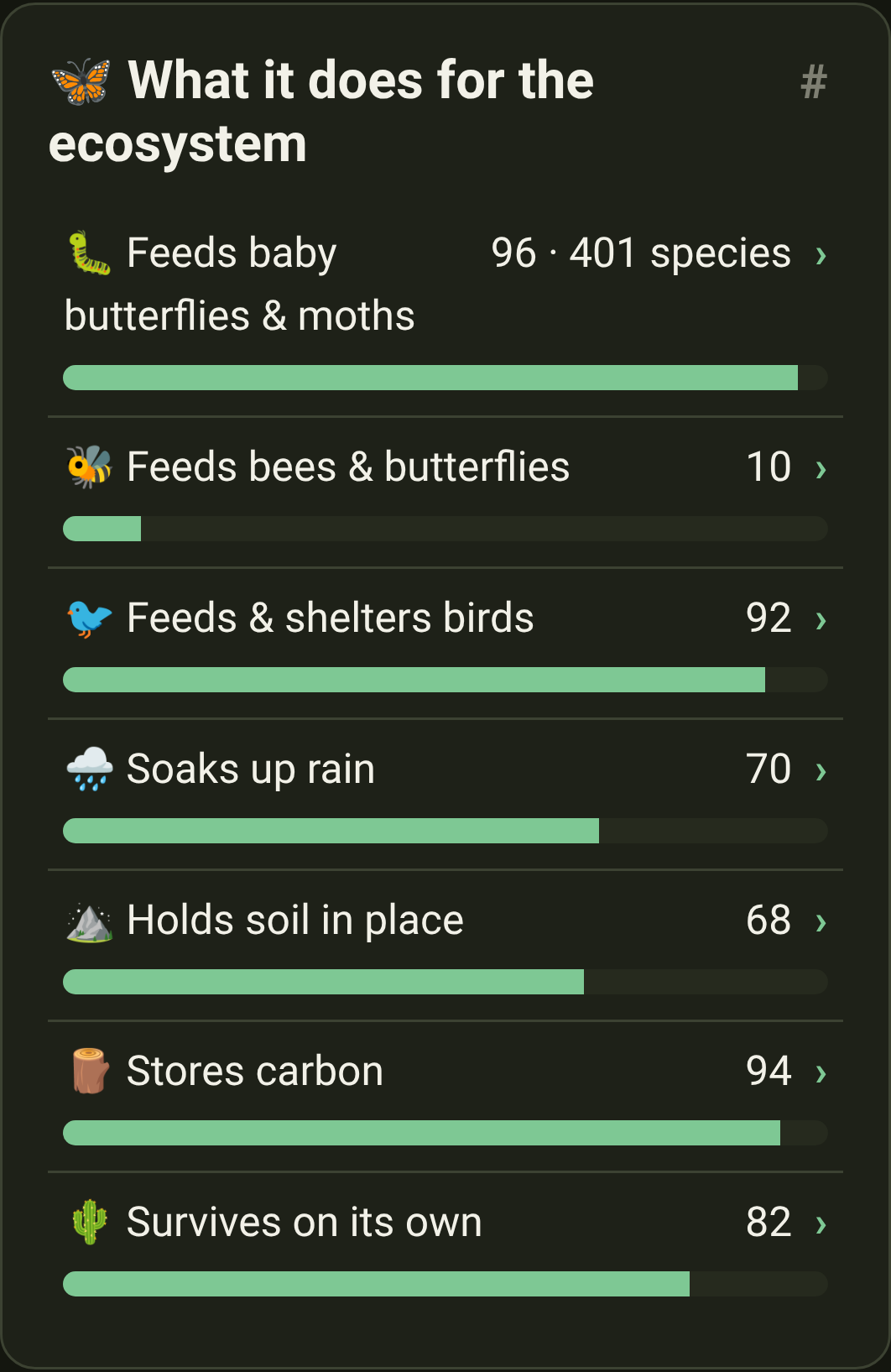
Added
- A hundred and thirty-six more animals named on the plants you can grow. Nine regions searched against an open database of published plant-and-animal records. Pairings went from 415 to 551; plants naming nothing at all fell from 78 to 19. Browse them at Wildlife.
- Every new pairing names the study that found it — a Swiss food web, a European pollinator network, the Natural History Museum's world list of what caterpillars eat. The sources page says so too.
- Four regions now name a creature for every plant they ship — Continental France, Mediterranean France, the Alps, and, but for two ferns, the Mid-Atlantic.
- Wildlife: Nine new creatures. The red admiral, silver-spotted skipper, spicebush swallowtail, Lorquin's admiral, anise swallowtail, eastern carpenter bee, bushtit, lesser goldfinch, and the brown-headed nuthatch — which uses a flake of bark as a tool to pry up more bark.
- Regions: Thirteen more Pacific Northwest natives, including the shrub the list most needed. Redstem ceanothus feeds more caterpillars than almost anything else out there and had been missing entirely. With it: red huckleberry, cascara, western trillium, fireweed, licorice fern and eight more. Seventy-one plants now.
- Regions: Something is in flower in October now. The region had exactly one plant open that month. Puget Sound gumweed flowers from July until the rain returns, so the last bees of the year have somewhere to go.
- Look-alikes: Cow parsnip has a dangerous twin, and the app now says which is which. Giant hogweed is twice the height and its sap can blind. Both burn skin in sunlight, so the look-alike page gives you the tells from a safe distance.
Changed
- What's new says the same things in half the words. Every entry on What's new has been cut back to what actually changed — the longest ran to 273 words, which is an essay, not a release note. The plant and region pages still hold the detail.
- The Before and After pictures open in the page now. Tapping one used to send you off to a bare image file on another site, with the back button for a way home. They open in the same viewer the app uses for photographs.
- And you can move between them. The ‹ › buttons, the ← → keys and a swipe all page through a release's pictures. Escape, ✕, the backdrop or a swipe down puts them away.
- The wildlife list is a list again. Browse by wildlife printed each creature's whole description, so a screenful of cards was a wall of text. A card now opens with a sentence or two; the animal's own page still has the rest.
- Wildlife: Every animal reads shorter, in French too. All 73 descriptions were rewritten to say the same thing and stop — the longest ran to 101 words — and the French was rewritten to match, so neither edition is the long one.
- An animal's page counts its plants in tiles. The monarch shows how many of our natives feed it, how many raise its young, and how many it has no substitute for — the same tiles a plant's page has. Tap one for what it means.
- An animal's page no longer calls it "a native animal". Every animal in Wildlife is native, and the page names the regions right beside it. What's left is the part that isn't repeated: where it's native in the wild, and who says so.
- Plants: "See it near you" is half as tall on a computer. Asking where to look and offering to look somewhere else were stacked down the page; they now sit side by side. On a phone, nothing moves.
- Wildlife: The honesty note at the foot of the wildlife pages is a footnote now — two sentences in small type with the sources link on the end, instead of a paragraph in the middle of the page. What it dropped moved into the 📍 pills.
- Regions: Region names are shorter, with the qualifier on the line below. "Florida (south & the Keys)" is now South Florida; "Pacific Northwest (west of the Cascades)" is Pacific Northwest. The brackets had been pushing a name onto three lines on a phone.
- Regions: On a laptop the region map is a sensible size now. It used to stretch the whole width of the page, which pushed the plant list off the bottom of the screen. On a phone, nothing changes.
- Regions: The list of ecoregion names under each map is gone. It read like a geology exam — "Ridge and Valley, Western Allegheny Plateau" — and the link underneath already says whose map the lines come from.
- Regions: Each region map is one shape now, and its coastline is smoother. The lines dividing it into a dozen pieces answered no question anyone asks, and the jagged edges were an artefact of keeping the file small.
Fixed
- Four notes meant for the people building Indigene had been appearing on What's new. They're written for developers and are supposed to stay out of the page — a stray pair of asterisks was enough to let them through.